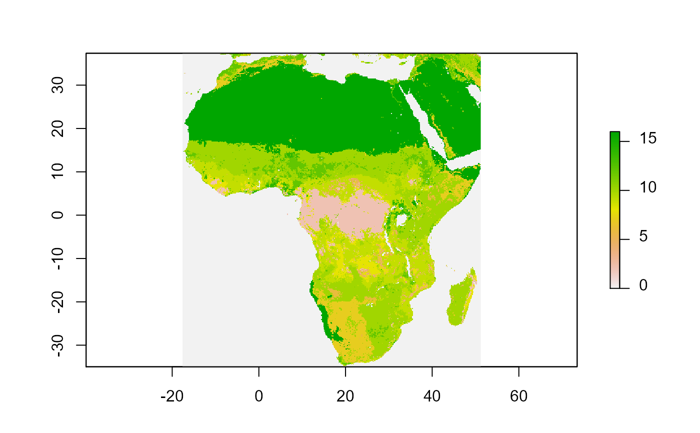
landcover raster for Africa, categorical, 20km resolution
afrilandcover.Rda raster object storing the majority landcover in 2019 for all 20km squares in Africa.
Categorical, 20km resolution from MODIS.
Cell values are numeric, landcover type names are stored in Raster Attribute Table (RAT) that can be accessed via levels(afrilandcover)
See data-raw/afrilearndata-creation.R for how the data object is created.
afrilandcover
Format
Formal class 'raster';
Geographical coordinates WGS84 datum (CRS EPSG 4326)
Source
https://lpdaac.usgs.gov/products/mcd12c1v006/
See also
Friedl, M., D. Sulla-Menashe. MCD12C1 MODIS/Terra+Aqua Land Cover Type Yearly L3 Global 0.05Deg CMG V006. 2015, distributed by NASA EOSDIS Land Processes DAAC, https://doi.org/10.5067/MODIS/MCD12C1.006. Accessed 2021-06-07.#'
Examples
if (requireNamespace("raster", quietly = TRUE)) { library(raster) data(afrilandcover) # or filename <- system.file("extdata","afrilandcover.grd", package="afrilearndata", mustWork=TRUE) afrilandcover <- raster::raster(filename) plot(afrilandcover) }#> Warning: package 'raster' was built under R version 4.0.5#>#> Warning: package 'sp' was built under R version 4.0.5# interactive plotting with mapview if (requireNamespace("mapview", quietly = TRUE) & requireNamespace("rgdal", quietly = TRUE)) { library(mapview) mapview(afrilandcover, att="landcover", col.regions=levels(afrilandcover)[[1]]$colour) }#> Warning: Discarded ellps WGS 84 in CRS definition: +proj=merc +a=6378137 +b=6378137 +lat_ts=0 +lon_0=0 +x_0=0 +y_0=0 +k=1 +units=m +nadgrids=@null +wktext +no_defs +type=crs#> Warning: Discarded datum World Geodetic System 1984 in CRS definition#> Warning: Discarded ellps WGS 84 in CRS definition: +proj=merc +a=6378137 +b=6378137 +lat_ts=0 +lon_0=0 +x_0=0 +y_0=0 +k=1 +units=m +nadgrids=@null +wktext +no_defs +type=crs#> Warning: Discarded datum World Geodetic System 1984 in CRS definition